Importation Procedure
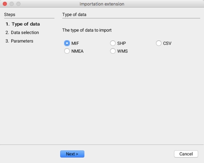
The graphical interface of the Importation extension, which can be accessed by going to Tools -> Import data in the Pro application, guides the user through the steps of the importation process.
Importation involves three sequential steps:
Selecting the type of data,
Selecting the data sets to import and
Configuring the parameters associated with each type of data.
Selecting the type of data

Five types of data formats can be imported:
MIF files, usually produced by MapInfo applications;
SHP files, usually produced by ESRI applications;
CSV files, which are text files with separate values containing X and Y geographical coordinates;
GPS data structured according to the NMEA standard; and
Raster data from servers that are compliant with the WMS standard.
The subsequent steps vary according to the format type of the data to import.
Mis à jour